Drainage Setouts
 The approved design plans from the engineer will specify the position and required levels of the new draiange. A Surveyor can ensure that manholes are located in the correct place and that the right levels are provided to ensure that the grades of the pipes allow the drainage to work. If the grades are not correct then the capacity of the pipe and downstream system is compromised and pipes may need to be relaid. Correct Setout helps ensure that this does not happen. Boundary Consultants are very experienced in this and will provide clear plans detailing what was Setout and when. Please contact us for advice and see below for examples of Setout plans.
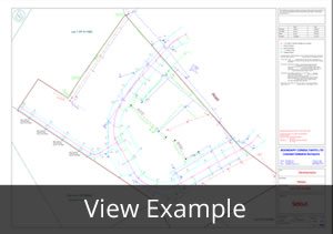
Drainage As-Builts
 As-Built Drainage plans are required by Councils when any new drainage works have been completed. A private drainage As-Built plan, drawn by a plumber/drainlayer, is required when new drainage from a building or driveway has been constructed. This will show the new drainage from the building/driveway to the point that it joins to the public drainage system (or to a kerb outlet).
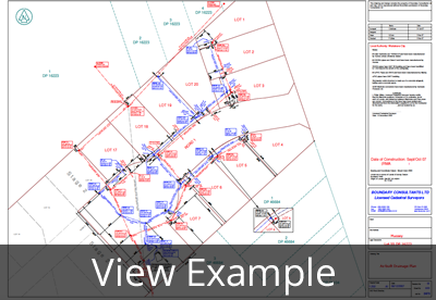
A public drainage As-Built plan, drawn by a Licensed Cadastral Surveyor is required when the public drainage system has been extended or new manholes/chambers constructed in the public system. This entails a Topographic (Site) Survey to confirm manhole lid/chamber positions and levels, invert levels on the inlets and outlets of pipes within manholes and cesspits, pipe sizes and types and the position of any new house connections. From this information an As-Built plan of the drainage is drawn, showing the information gathered above. Offset bearings and distances to the nearest boundary for manholes/chambers and house connections will also be shown. The co-ordinates will be provided in the datum required by the relevant Council (Please note that each Council has different requirements for As-Built plans).
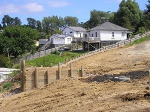
Retaining Wall Setouts
It is not always necessary to have a Retaining Wall Setout, but if they are in close proximity to boundaries (within 1m) or close to a new building, it is essential to ensure that they are in the right place and height.
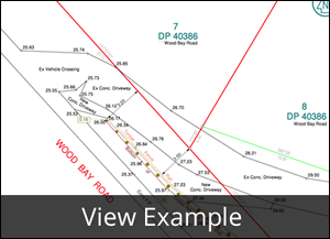
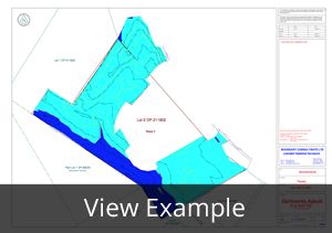
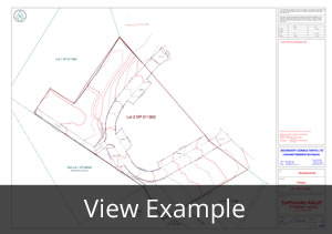
Road and Driveway Setouts
Road and Driveway Setouts ensure that new road/driveways are built to the design plans. Generally stakes are set out at 10 or 20m intervals at an offset to the proposed kerb line to allow earthmoving equipment access between the stakes. Stakes are marked with heights as shown on the design plans. These marks help the Contractors to keep the correct gradients on the new road / driveway as designed. The image is an example of a Setout plan for a private road.
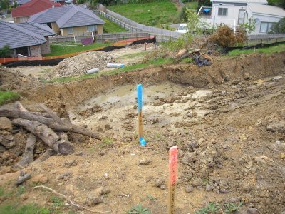
Earthworks Cut and Fill Setouts
These are done when there is major earthworks to be done on site. Marks are placed to indicate to the contractors where there is to be cut or fill and how much is needed to hit the design level. This is a good way to make sure you get your terraced development how you designed it.
Earthworks and Quantities
When there are major earthworks involved in a job, contractors need to know how much cut and fill was completed (usually for cost purposes). Council and Engineers like to know where and how much cut and fill was done for Geotechnical reasons. To make sure this is done correctly, it is essential to undertake a site survey of the section before any works are done. This is used as the baseline for the site. After the earthworks have been completed, another site survey of the site is undertaken to get the finished levels. By putting these two surveys together, we can calculate the areas of cut and fill and draw up a plan showing how much and where the cut and fill is.