Building Setout

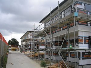
Having your building set out by a Licensed Cadastral Surveyor can save a lot of time and cost further down the track. Councils often require a Setout certificate when you apply for a code of compliance certificate at the completion of the building process. The consequences of a building being in the incorrect place can be expensive.
We recently worked with a client whose building was set out by the builder and the floor level was raised by 600mm and the house positioned 800mm away from where it had been shown on the approved plans. This resulted in delays of over 6 weeks and additional costs of over $10,000.  Amended building plans and an application for new resource consent infringements for height in relation to boundary and outdoor living space were required. Make sure this does not happen to you! It would have cost less than a 1/10 of the cost to have the building set out correctly in the first place, with no time delays.

Send a copy of your building plans to us and we will provide professional advice on what level of surveying you require to ensure that your project runs smoothly through to completion.

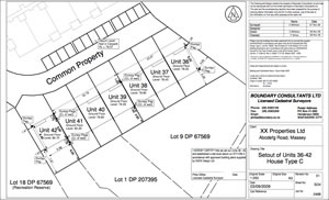
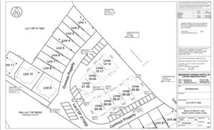
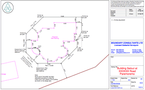
Boundary Consultants provide a clear Setout diagram for each building set out, so it is clear exactly what has been marked and at what level. This makes for clear understanding and reduced mistakes. Below are three examples of Setout diagrams: for a multi-story unit; single story terraced houses; and a rural dwelling. Click on the images for enlargements.

Height in Relation to Boundary (HIRB)

The height of a building, in relation to the distance the building is from the boundary, is a way Councils regulate how much neighbouring properties are affected by a development. The effects of an infringement under the height in relation to boundary rules relate to access to sunlight and daylight for all properties. Different councils vary the requirements and they can vary between different zones within a Council area.
If a new building is involved, the architect for the project will show height in relation to boundary (HIRB) calculations on the building plans. If the proposed building is close to the HIRB limits, it is quite common for Council to require that the actual HIRB be checked by a Licensed Cadastral Surveyor before proceeding beyond the foundation stage of the new building. Sometimes additional checks are required at the framing stage as well.
If your building is close to the HIRB limit, we strongly recommend that it be checked by a Licensed Surveyor as early in the process as possible. Mistakes can be very costly (in both time and money) and can involve a Resource Consent application (with neighbours approval) and sometimes alterations to the building to make it comply.
Where a subdivision is proposed around existing dwellings, HIRB calculations are also required to ensure that the existing buildings will not infringe HIRB on the proposed new boundaries within the site.  We are able to make these calculations for you once the ground levels on the site and the dimensions of the buildings have been identified (through the Site Survey process).

Boundary Consultants know the potential difficulties and can help you avoid them. We will look at your building plans and provide advice on the issues involved. Please contact us.

Resource Consent

If your building encroaches the HIRB, or you are planning for an encroachment, then a Resource Consent is required. One of the major issues that Council will consider is the effect the building will have on the neighbouring property. If you can gain that neighbour’s approval for the encroachment, this will greatly enhance the chances of success.